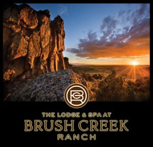
Platte Valley Jingle Mingle 2023

Fax: (307) 326-8850
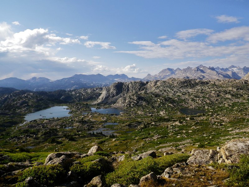
Snowy Range and Sierra Madre Mountains offer 44 hiking trails for the novice and experienced hiker. The trails vary from .2 miles to 45.9 miles and range from easy, like the short, comfortable terraiFlowers-Hike n at the Indian Bathtubs or picturesque Lake Marie Falls, to difficult, such as the Bottle Creek or Platte Ridge runs. Most hiking trails are above 8,000 ft, so we encourage you to dress appropriately. Hiking in the mountains allows you see things that you can’t see from a car!
The Continental Divide Trail is unique to the Sierra Madre Range. It is part of the 2500 mile Great Divide Mountain Bike Route that follows the Continental Divide from the Canadian border to Mexico. This trail climbs above 10,000 ft with some of the best vistas in Carbon County. Many historical buildings, remnants of the mining era, offer extra excitement. The trail can be accessed from the north near the historic town of Battle via Hwy 70.
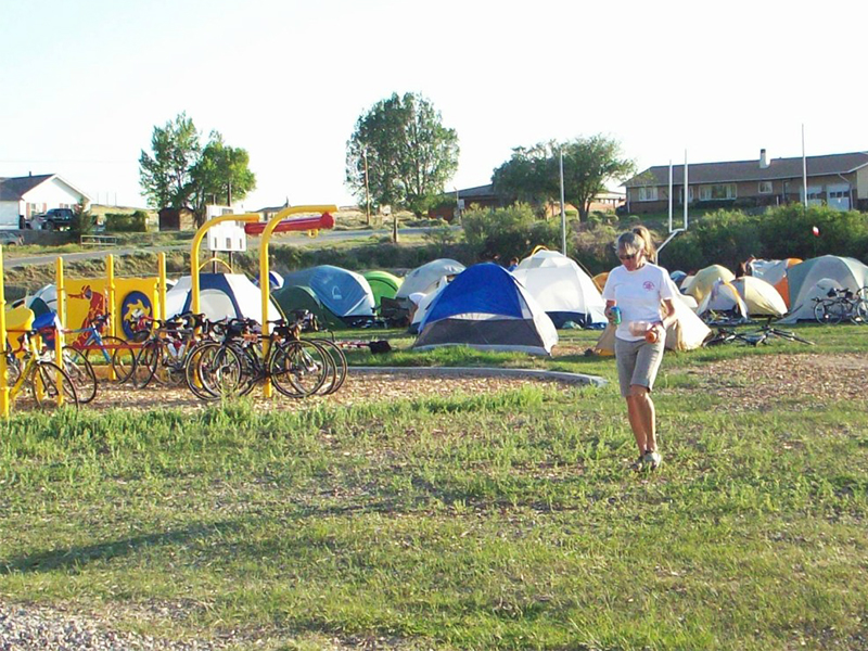
Those following the TransAmerica cycling route, a route that traverses the United States from Oregon to Virginia, will know this area as Section 6, which begins in Rawlins, Wyoming and ends in Pueblo, Colorado. This 391-mile stretch takes you from the rolling plains of south-central Wyoming, through the Upper North Platte Valley of Saratoga and Riverside and down the Rockies through Walden, Kremmling and Breckenridge. Just past this point, you’ll climb over Hoosier Pass, gaining 1500′ elevation within 10 miles to the highest part of the TransAmerica Trail, elevation 11, 542′! Royal Gorge and Canyon City are next, with the ride ending in Pueblo, the halfway point of the TransAmerica Trail. Overall, you’ll experience high desert, snow-capped mountain passes, breathtaking visas, rolling plains, and sweet, unique small-town America at its best.
The Platte Valley hosts hundreds of cyclists as individuals and small groups, to large groups of rally riders and tours. Bicycle Tour of Colorado recently rode the Snowy Range and Battle Highway passes as part of their first ride into Wyoming. Charitable groups such as Wyoming Cares and Tour de Wyoming find the Valley a favorite destination.
101 Best Outdoor Towns: Unspoiled Places to Visit, Live & Play (1st edition, 2007)
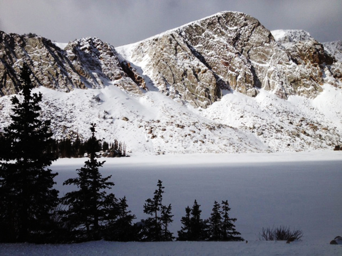
Snowy Range Scenic Byway crosses the Medicine Bow Mountain Range of southern Wyoming, taking travelers close enough to Medicine Bow Peak to feel the chill from its year-round glaciers. Even deep into summer, it is easy to see how the Snowy Range got its name. Glistening white remnants of last winter’s blizzards cap the 12,000 ft peaks. The byway includes the 27 mile portion of WY Highway 130 that crosses the Medicine Bow National Forest.
The two-lane highway (WY 130) leads over the second highest mountain pass in Wyoming and takes the traveler from low-land sagebrush prairie to a high-altitude alpine environment. The many lakes and streams in the area are home to rainbow trout, brook trout and Wyoming’s only native trout, the cutthroat. Wildflowers carpet the alpine meadows throughout the summer.
A number of turn-outs allow the traveler to experience the mountains, whether it is listening to the marmots whistling amongst their community at Libby Flats, taking the short trail over a mountain stream at Lake Marie, or watching hummingbirds at the Brush Creek Visitor’s Center. Wildlife is abundant throughout the byway.
The seasonal pass usually opens by Memorial Day weekend and closes about mid-October. The Byway can be reached by exiting Interstate 80 at Laramie or at Walcott Junction and Saratoga/Encampment. Driving time depends on the interests of the visitor. Driving straight through during the summer will take about an hour. The route rises to a height of 10,847 ft above sea level.
Battle Highway Scenic Highway (WY Highway 70) goes from Encampment over the Sierra Madre Range within the Medicine Bow National Forest. Approximately 10 miles west of Encampment is the location of Battle, one of many ghost towns in the Sierra Madres, which also is home to the towns of Redefeha, Dillon, Rambler, and Copperton.
Two miles west of the Continental Divide is a turnout overlooking Battle Lake and a monument to Thomas A. Edison. While vacationing here in 1878, Edison threw a broken bamboo fishing pole in the fire and was intrigued by the way the frayed pieces glowed. These observations supposedly gave Edison the idea on how to develop his own design for the light bulb’s filament.
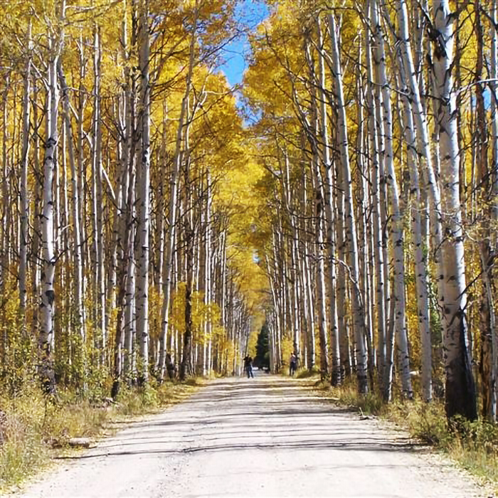
Another attraction of the Sierra Madres is the Aspen Alley. These large stands of quaking aspens moved into the region during the mining era. This particularly famous strand of beautifully flamboyant foliage is most beautiful in the fall and can be reached by turning north on Forest Road 801. The colors generally peak in late September.
From Saratoga, go south on Highway 130 to Highway 230 on to Encampment ( a quick 20 minute trip). From Encampment turn west on Battle Highway (Highway 70) across the Sierra Madre towards Baggs to go to “Aspen Alley” – a beautiful area filled with very tall aspen trees overarching a half mile stretch of dirt road. On Highway 70 leaving Encampment, travel west approximately 25 miles to Deep Creek Road (Forest Road 801). From there you will travel north just .8 miles which will lead right to Aspen Alley.
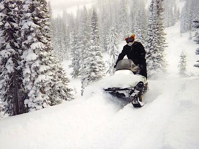
The Medicine Bow National Forest offers over 475 miles of trails for snowmobilers. Snow depths can range from 2 ft to 12 ft! The combination of snowmobile and marked trails for skiing and snowshoeing make the Upper North Platte River Valley a winter destination.
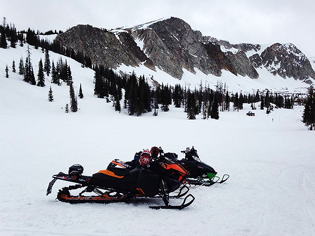
Snowy Range Mountains, located between Encampment and Saratoga, have been consistently rated in the top 5 of “Top 15 Trails in the West” for snowmobiling by SnoWest magazine. The Snowy Range Trail System is maintained through cooperative efforts of the Wyoming Department of State Park & Cultural Resources – Division of State Parks & Historic Sites and the U.S. Forest Service.
There are 175 of groomed trails and 150 miles of ungroomed trails with signs, and several meadows have deep powder with snow depths of 12 ft possible. Public lands for snowmobiling with lodging and guided tours available make the Snowy Range Mountains an excellent destination for beginners and advanced snowmobilers. Elevations range from 7,000 to 11,000 ft, with season temperatures from November to May ranging from +30˚F to -30°F.
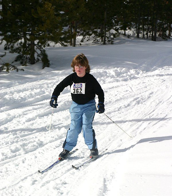
Cross-country skiiers and snowshoers can enjoy the Brush Creek Ski Trail and the Bottle Creek Ski Trail in the Sierra Madre Mountains, just minutes from Encampment. Snow machines are prohibited from both trails, and they are maintained for those who enjoy the quiet and serenity of the forest. The trails are laid out in a series of loops ranging in length so you can plan your adventure. With names like “Starvation Trail” and “Windy Point,” you can count on a great experience. Maps showing the direction of difficult slopes and the mileage are available at the Chamber and the USFS Ranger Station.
Groomed trails for cross country skiers and snowmobilers in the Snowy Range Mountains and Sierra Madre Mountains exceed 300 miles, and with an annual snowfall of over 20 ft, there is sure to be plenty of powder for everyone.
Information on travel restrictions, OSV registrations and trail closures may also be found on the Medicine Bow National Forest website.
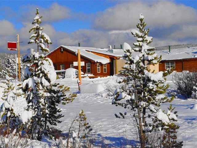
photo right: The Rendezvous Lodge